- 0 Shopping Cart


The Somerset Levels Flood Case Study
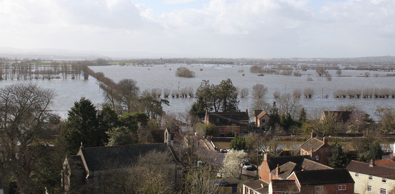
The Somerset Levels are a coastal plain and wetland area in Somerset, England. Thousands of years ago, the area was covered by the sea, but today it’s a landscape of rivers and wetlands – artificially drained, irrigated and modified to allow productive farming.
It is claimed that the Somerset Levels are one of the lowest areas in the UK. This is because much of the area lies below the high-water mark of spring tides. The area is very flat and has a maximum altitude of 8m above sea level. All rivers in this area, including Axe, Sheppey and Brue, are in the north, while to the south, the rivers the Cary, Yeo, Tone and Parrett drain into the Bristol Channel.
In January 2014, the Somerset Levels experienced floods greater than any other in living memory. Estimates suggest that 10% of the area was underwater when the flooding was greatest.
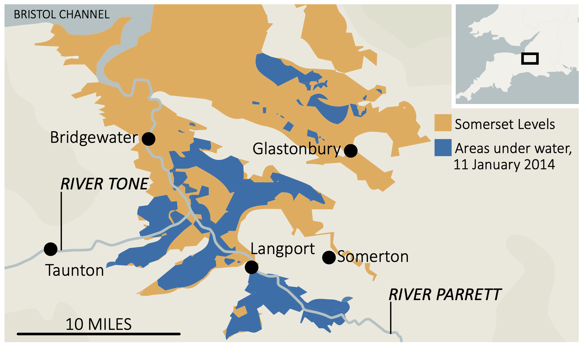
Somerset Levels 2014 flood map
What were the physical causes of flooding in the Somerset Levels?
A quick succession of prolonged Atlantic storms, with persistent rainfall and gale-force winds, was the primary cause of flooding. The rivers could not cope with the significant amount of rain that fell. High tides in the Bristol Channel and its narrowing also create tidal surges. These blocked the floodwater, trying to escape the Somerset Levels. Coastal defences coped with the tidal surges.
What were the human causes of flooding in the Somerset Levels?
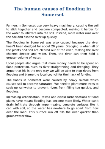
There had been less dredging of the river channels on the Somerset Levels leading up to 2014. However, as a result, the channels had risen due to sediment accumulation. This reduced the capacity of rivers to transport water, leading to flooding.
Change in farming practices has also contributed to flooding. Much of the land has been converted from grassland to grow maise. This more intensive use of the land means it is less able to retain water, causing it to run over the surface rather than being absorbed.
What were the impacts of flooding in the Somerset Levels?
The flood was the most significant hazard to affect this area ever. The event was so significant it dominated the national news coverage.
The flooding had a range of social, economic and environmental impacts.
What were the social impacts of the Somerset Levels floods?
Over 600 homes and 16 farms were evacuated, resulting in many people requiring temporary accommodation, where many stayed for several months. In addition, several villages, such as Moorland and Muchelney, were cut off after roads were flooded. Power supplies were cut off during a time when temperatures were low.
What were the economic impacts of the Somerset Levels floods?
Somerset County Council estimates that the cost of flood damage was over £10 million. The agricultural industry was among the hardest hit, with over fourteen thousand hectares of agricultural land used for crops and grazing flooded for three to four weeks. One thousand livestock were evacuated from the affected farms.
Many main roads were closed, including the A361 linking Taunton and Street. Flooding disrupted train services on the main Bristol line between Taunton and Bridgwater.
Fuel used to power emergency pumps cost £200 000 per week. An estimated £1 million was lost by local businesses. The Somerset floods cost the county’s tourism industry an estimated £200 million.
There were several incidents of crime during the floods. Nine hundred litres of fuel was stolen from a pumping station in Westonzoyland. There were also reports of heating oil and quad bikes being stolen from homes affected by flooding.
Insurance costs increased in flood-hit areas of Somerset.
What were the environmental impacts of the Somerset Levels floods?
The environmental impact included the extensive contamination of floodwaters by sewage, oil, and various chemical pollutants. Following the recession of floodwaters, a significant amount of debris required clearing, while stagnant water accumulated over several months needed to be re-oxygenated before reintroduction into rivers. Failure to do so would have caused substantial harm to marine ecosystems.
The soil was damaged after being underwater for nearly three months. In some areas, it took over two years to restore the soil before crops could be grown.
Immediate response to the Somerset Levels flood
As expected for a high-income country (HIC), the response to the flood was well-organised and rapid.
Local people in South West England were warned of heavy rain when the Met Office issued an amber warning. The public was advised to prepare for significant flooding by the Environmental Agency. Many people used sandbags to protect their property and moved valuable items upstairs. In Moorland, a man constructed a large wall out of clay and mud to protect his house from flooding.
Rescue boats were used to help stranded people by the fire brigade who also visited hundreds of properties. Rescue crews supported residents of Moorland in evacuating. The owners of some 80 homes agreed to evacuate; however, around 30 residents stayed at home. Additional police patrols were introduced as a result of increased crime.
The army was sent into the area with specialist equipment towards the end of January. They issued sandbags and distributed food. 40 Royal Marines later joined them to provide additional support.
Sixty-five pumps were used to drain 65 million m3 of floodwater.
Local people, led by the Flooding on the Levels Action Group (FLAG), provided local support to the people affected. This included fundraising and the collection and distribution of food. They also used social media, such as Facebook and Twitter, to share the news.
The government made an estimated £15m to meet the immediate costs of protecting lives and properties.
Long-term response to the Somerset Levels flood
The long-term response to the Somerset Levels flood focussed on management techniques to reduce the risk of future floods. As a result, the Somerset Levels and Moors Action Plan was developed and included measures such as reintroducing dredging, constructing a tidal barrage and additional permanent pumping stations. The scheme is part of a 20-year plan for the Somerset Levels and will total £100 million.

Premium Resources
Please support internet geography.
If you've found the resources on this page useful please consider making a secure donation via PayPal to support the development of the site. The site is self-funded and your support is really appreciated.
Related Topics
Use the images below to explore related GeoTopics.
Topic Home
Next topic page, share this:.
- Click to share on Twitter (Opens in new window)
- Click to share on Facebook (Opens in new window)
- Click to share on Pinterest (Opens in new window)
- Click to email a link to a friend (Opens in new window)
- Click to share on WhatsApp (Opens in new window)
- Click to print (Opens in new window)
If you've found the resources on this site useful please consider making a secure donation via PayPal to support the development of the site. The site is self-funded and your support is really appreciated.
Search Internet Geography
Top posts and pages.
Latest Blog Entries
Pin It on Pinterest
- Click to share
- Print Friendly
Live revision! Join us for our free exam revision livestreams Watch now →
Reference Library
Collections
- See what's new
- All Resources
- Student Resources
- Assessment Resources
- Teaching Resources
- CPD Courses
- Livestreams
Study notes, videos, interactive activities and more!
Geography news, insights and enrichment
Currated collections of free resources
Browse resources by topic
- All Geography Resources
Resource Selections
Currated lists of resources
- Topic Videos
Topic Video for AQA GCSE Geography: Somerset Levels Flooding (Weather Hazards 12)
Last updated 29 Apr 2024
- Share on Facebook
- Share on Twitter
- Share by Email
This topic video looks at the case study of the Somerset Levels Floods which is a popular case study for the UK extreme weather event. We explore the factors that led to such extensive flooding, the social, economic and environmental impacts of the flooding, along with the immediate and long-term responses used to help the people affected.
It is part of the AQA GCSE Geography course - Paper 1: Unit A - The Challenge of Natural Hazards.
- The video is a revision resource for AQA GCSE Geography, specifically focusing on the Somerset Levels floods.
- The floods occurred in January and February 2014, marking one of the worst incidents of flooding in recent years.
- Somerset is in South West England, characterized by low-lying farmland and wetlands known as the Somerset Levels and Moors.
- The area is bordered by the Bristol Channel, Quantock Hills to the west, and Mendip Hills to the north.
- The floods were triggered by the wettest January on record, with 35 centimeters of rain falling in January and February—10 centimeters more than average.
- High tides clashed with storm surges, blocking fresh water from reaching the sea, and local rivers, not dredged for over 20 years, had reduced capacity.
- Social impacts included over 600 houses flooded, 16 farms evacuated, and villages cut off, leading to significant disruptions in daily life.
- Economic impacts estimated at over £10 million, affecting farming, trade, and infrastructure.
- Environmental impacts involved contaminated floodwaters with sewage and pollutants, requiring extensive cleanup.
- Immediate responses included evacuations, temporary accommodations, and support from volunteers.
- Long-term responses involved a £20 million flood action plan, including dredging rivers, raising road levels, installing flood defenses, and strengthening Riverbanks to mitigate future risks.
- Weather events
- Extreme weather
- Weather hazards
You might also like

3 great simulation games for geography lessons
2nd February 2016
The Need for More Resilient Cities
28th December 2015
16 million people affected by seasonal floods in southern Asia
19th August 2017

When climate change adaptation can make things worse
4th April 2018
Japanese floods
9th July 2018
Weather Hazards - GCSE MCQ Quiz
Quizzes & Activities
GCSE Geography | The Structure of the Earth (Tectonic Hazards 1)
Study Notes
Tri-Dominoes - Weather Hazards (Paper 1) | Revision Activity
Teaching Activities
Our subjects
- › Criminology
- › Economics
- › Geography
- › Health & Social Care
- › Psychology
- › Sociology
- › Teaching & learning resources
- › Student revision workshops
- › Online student courses
- › CPD for teachers
- › Livestreams
- › Teaching jobs
Boston House, 214 High Street, Boston Spa, West Yorkshire, LS23 6AD Tel: 01937 848885
- › Contact us
- › Terms of use
- › Privacy & cookies
© 2002-2024 Tutor2u Limited. Company Reg no: 04489574. VAT reg no 816865400.
UK Weather Hazards Case Study: Somerset 2014
Extreme weather in the uk - somerset levels floods 2014.
Flooding affected the Somerset Levels in 2014. The Somerset Levels is a low-lying area of south-west England.

Record rainfall
- The record rainfall caused the rivers and drains to overflow.

Tidal rivers
- Tidal rivers go up and down with the tide.
- High tides made the flooding worse.
The Environment Agency
- Some people blamed the Environment Agency for the flooding as the rivers hadn't been dredged for 20 years.
- Dredging a river is when you take out mud from the bed of a river.
Effects & Responses
Flooding affected the low-lying Somerset Levels in 2014. Let's have a look at the varying effects and responses.
Effects of the floods
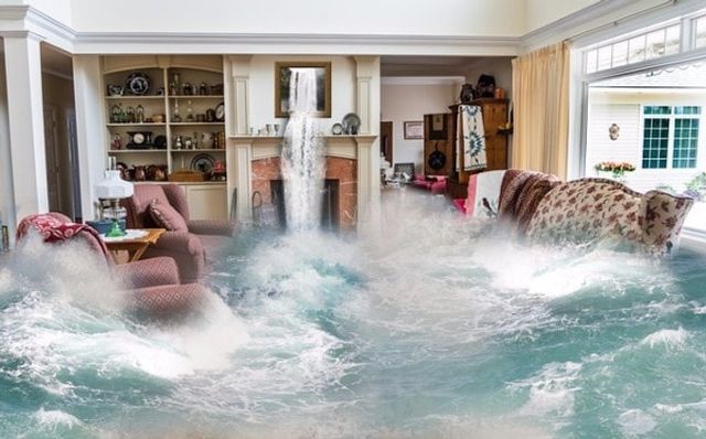
- The social impact was that over 600 houses were flooded.
- The economic impact was that there was an estimated £10 million of damage.
- The waste was deposited when the floods receded.

Immediate responses
- The evacuation of people from villages (e.g. Moorland).
- Support from community groups and volunteers.


Long term responses
- The announcement of a £20 million Flood Action Plan by the Environment Agency and Somerset County Council.
- 8 km of rivers were dredged.
1 The Challenge of Natural Hazards
1.1 Natural Hazards
1.1.1 Types of Natural Hazards
1.1.2 Hazard Risk
1.1.3 Consequences of Natural Hazards
1.1.4 End of Topic Test - Natural Hazards
1.1.5 Exam-Style Questions - Natural Hazards
1.2 Tectonic Hazards
1.2.1 Tectonic Plates
1.2.2 Tectonic Plates & Convection Currents
1.2.3 Plate Margins
1.2.4 Volcanoes
1.2.5 Effects of Volcanoes
1.2.6 Responses to Volcanic Eruptions
1.2.7 Earthquakes
1.2.8 Earthquakes 2
1.2.9 Responses to Earthquakes
1.2.10 Case Studies: The L'Aquila & Kashmir Earthquakes
1.2.11 Earthquake Case Study: Chile 2010
1.2.12 Earthquake Case Study: Nepal 2015
1.2.13 Living with Tectonic Hazards 1
1.2.14 Living with Tectonic Hazards 2
1.2.15 End of Topic Test - Tectonic Hazards
1.2.16 Exam-Style Questions - Tectonic Hazards
1.2.17 Tectonic Hazards - Statistical Skills
1.3 Weather Hazards
1.3.1 Global Atmospheric Circulation
1.3.2 Surface Winds
1.3.3 UK Weather Hazards
1.3.4 Tropical Storms
1.3.5 Features of Tropical Storms
1.3.6 Impact of Tropical Storms 1
1.3.7 Impact of Tropical Storms 2
1.3.8 Tropical Storms Case Study: Katrina
1.3.9 Tropical Storms Case Study: Haiyan
1.3.10 UK Weather Hazards Case Study: Somerset 2014
1.3.11 End of Topic Test - Weather Hazards
1.3.12 Exam-Style Questions - Weather Hazards
1.3.13 Weather Hazards - Statistical Skills
1.4 Climate Change
1.4.1 Evidence for Climate Change
1.4.2 Causes of Climate Change
1.4.3 Effects of Climate Change
1.4.4 Managing Climate Change
1.4.5 End of Topic Test - Climate Change
1.4.6 Exam-Style Questions - Climate Change
1.4.7 Climate Change - Statistical Skills
2 The Living World
2.1 Ecosystems
2.1.1 Ecosystems
2.1.2 Ecosystem Cascades & Global Ecosystems
2.1.3 Ecosystem Case Study: Freshwater Ponds
2.2 Tropical Rainforests
2.2.1 Tropical Rainforests - Intro & Interdependence
2.2.2 Adaptations
2.2.3 Biodiversity of Tropical Rainforests
2.2.4 Deforestation
2.2.5 Case Study: Deforestation in the Amazon Rainforest
2.2.6 Sustainable Management of Rainforests
2.2.7 Case Study: Malaysian Rainforest
2.2.8 End of Topic Test - Tropical Rainforests
2.2.9 Exam-Style Questions - Tropical Rainforests
2.2.10 Deforestation - Statistical Skills
2.3 Hot Deserts
2.3.1 Overview of Hot Deserts
2.3.2 Biodiversity & Adaptation to Hot Deserts
2.3.3 Case Study: Sahara Desert
2.3.4 Desertification
2.3.5 Case Study: Thar Desert
2.3.6 End of Topic Test - Hot Deserts
2.3.7 Exam-Style Questions - Hot Deserts
2.4 Tundra & Polar Environments
2.4.1 Overview of Cold Environments
2.4.2 Adaptations in Cold Environments
2.4.3 Biodiversity in Cold Environments
2.4.4 Case Study: Alaska
2.4.5 Sustainable Management
2.4.6 Case Study: Svalbard
2.4.7 End of Topic Test - Tundra & Polar Environments
2.4.8 Exam-Style Questions - Cold Environments
3 Physical Landscapes in the UK
3.1 The UK Physical Landscape
3.1.1 The UK Physical Landscape
3.2 Coastal Landscapes in the UK
3.2.1 Types of Wave
3.2.2 Weathering & Mass Movement
3.2.3 Processes of Erosion & Wave-Cut Platforms
3.2.4 Headlands, Bays, Caves, Arches & Stacks
3.2.5 Transportation
3.2.6 Deposition
3.2.7 Spits, Bars & Sand Dunes
3.2.8 Case Study: Landforms on the Dorset Coast
3.2.9 Types of Coastal Management 1
3.2.10 Types of Coastal Management 2
3.2.11 Coastal Management Case Study - Holderness
3.2.12 Coastal Management Case Study: Swanage
3.2.13 Coastal Management Case Study - Lyme Regis
3.2.14 End of Topic Test - Coastal Landscapes in the UK
3.2.15 Exam-Style Questions - Coasts
3.3 River Landscapes in the UK
3.3.1 The River Valley
3.3.2 River Valley Case Study - River Tees
3.3.3 Erosion
3.3.4 Transportation & Deposition
3.3.5 Waterfalls, Gorges & Interlocking Spurs
3.3.6 Meanders & Oxbow Lakes
3.3.7 Floodplains & Levees
3.3.8 Estuaries
3.3.9 Case Study: The River Clyde
3.3.10 River Management
3.3.11 Hard & Soft Flood Defences
3.3.12 River Management Case Study - Boscastle
3.3.13 River Management Case Study - Banbury
3.3.14 End of Topic Test - River Landscapes in the UK
3.3.15 Exam-Style Questions - Rivers
3.4 Glacial Landscapes in the UK
3.4.1 Erosion
3.4.2 Landforms Caused by Erosion
3.4.3 Landforms Caused by Transportation & Deposition
3.4.4 Snowdonia
3.4.5 Land Use in Glaciated Areas
3.4.6 Tourism in Glacial Landscapes
3.4.7 Case Study - Lake District
3.4.8 End of Topic Test - Glacial Landscapes in the UK
3.4.9 Exam-Style Questions - Glacial Landscapes
4 Urban Issues & Challenges
4.1 Urban Issues & Challenges
4.1.1 Urbanisation
4.1.2 Urbanisation Case Study: Lagos
4.1.3 Urbanisation Case Study: Rio de Janeiro
4.1.4 UK Cities
4.1.5 Case Study: Urban Regen Projects - Manchester
4.1.6 Case Study: Urban Change in Liverpool
4.1.7 Case Study: Urban Change in Bristol
4.1.8 Sustainable Urban Life
4.1.9 End of Topic Test - Urban Issues & Challenges
4.1.10 Exam-Style Questions - Urban Issues & Challenges
4.1.11 Urban Issues -Statistical Skills
5 The Changing Economic World
5.1 The Changing Economic World
5.1.1 Measuring Development
5.1.2 Classifying Countries Based on Wealth
5.1.3 The Demographic Transition Model
5.1.4 Physical & Historical Causes of Uneven Development
5.1.5 Economic Causes of Uneven Development
5.1.6 How Can We Reduce the Global Development Gap?
5.1.7 Case Study: Tourism in Kenya
5.1.8 Case Study: Tourism in Jamaica
5.1.9 Case Study: Economic Development in India
5.1.10 Case Study: Aid & Development in India
5.1.11 Case Study: Economic Development in Nigeria
5.1.12 Case Study: Aid & Development in Nigeria
5.1.13 Economic Development in the UK
5.1.14 Economic Development UK: Industry & Rural
5.1.15 Economic Development UK: Transport & North-South
5.1.16 Economic Development UK: Regional & Global
5.1.17 End of Topic Test - The Changing Economic World
5.1.18 Exam-Style Questions - The Changing Economic World
5.1.19 Changing Economic World - Statistical Skills
6 The Challenge of Resource Management
6.1 Resource Management
6.1.1 Global Distribution of Resources
6.1.2 Food in the UK
6.1.3 Water in the UK 1
6.1.4 Water in the UK 2
6.1.5 Energy in the UK
6.1.6 Resource Management - Statistical Skills
6.2.1 Areas of Food Surplus & Food Deficit
6.2.2 Food Supply & Food Insecurity
6.2.3 Increasing Food Supply
6.2.4 Case Study: Thanet Earth
6.2.5 Creating a Sustainable Food Supply
6.2.6 Case Study: Agroforestry in Mali
6.2.7 End of Topic Test - Food
6.2.8 Exam-Style Questions - Food
6.2.9 Food - Statistical Skills
6.3.1 The Global Demand for Water
6.3.2 What Affects the Availability of Water?
6.3.3 Increasing Water Supplies
6.3.4 Case Study: Water Transfer in China
6.3.5 Sustainable Water Supply
6.3.6 Case Study: Kenya's Sand Dams
6.3.7 Case Study: Lesotho Highland Water Project
6.3.8 Case Study: Wakel River Basin Project
6.3.9 Exam-Style Questions - Water
6.3.10 Water - Statistical Skills
6.4.1 Global Demand for Energy
6.4.2 Factors Affecting Energy Supply
6.4.3 Increasing Energy Supply: Renewables
6.4.4 Increasing Energy Supply: Non-Renewables
6.4.5 Carbon Footprints & Energy Conservation
6.4.6 Case Study: Rice Husks in Bihar
6.4.7 Exam-Style Questions - Energy
6.4.8 Energy - Statistical Skills
Jump to other topics

Unlock your full potential with GoStudent tutoring
Affordable 1:1 tutoring from the comfort of your home
Tutors are matched to your specific learning needs
30+ school subjects covered
Tropical Storms Case Study: Haiyan
End of Topic Test - Weather Hazards
Resources you can trust
Take 10: Somerset Levels case study
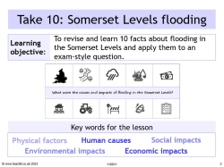
Use this engaging case study resource to summarise and recap key information about the Somerset Levels floods, and practise important exam skills with guidance and support for students.
It uses the principles of dual coding and retrieval process, to help students learn and recall 10 key facts about the Somerset Levels and the flood event, before moving on to apply that knowledge and practise exam technique.
What's included?
The resources include a PowerPoint with a lesson starter and a printable worksheet with revision tips, exam questions and mark schemes for peer and self-assessment.
The case study summary covers the physical and human factors that increased the risk of flooding, including the extreme weather and heavy rain experienced that winter and building on the floodplain. It also includes useful examples of environmental impacts, as well as social impacts and economic impacts of the river flooding. Students will also learn about some of the long-term responses, including the Flood Action Plan created by the Environment Agency and flood defences put in place to mitigate future flooding.
Somerset Levels GCSE case study
The Somerset floods is a useful example for students to use in the weather hazards and climate change topics within the GCSE specifications. This revision resource can be used for all GCSE geography exam boards.
An extract from the 10 facts:
Somerset is in south-west England. The Somerset Levels and moors form an extensive area of low-lying farmland and wetlands.
The area is drained by several rivers, e.g. the river Tone and the Parrett, which flow to the Severn Estuary.
Rivers had not been dredged for at least 20 years and had become clogged with sediment.
Somerset County Council estimated the cost of flood damage to be more than £10 million.
Over 600 houses were flooded - many were evacuated to temporary accommodation for several months.
Local roads were cut off by floods. Bristol to Taunton railway line closed at Bridgwater.
£20 million Flood Action Plan – dredging, raised river banks, raised roads and a pumping station.
All reviews
Resources you might like.
- International
- Education Jobs
- Schools directory
- Resources Education Jobs Schools directory News Search
Flooding in Somerset case study lesson
Subject: Geography
Age range: 14-16
Resource type: Lesson (complete)
Last updated
22 March 2018
- Share through email
- Share through twitter
- Share through linkedin
- Share through facebook
- Share through pinterest

Case study lesson on the Somerset floods designed for the AQA Geography (9-1) curriculum.
Range of individual and paired activities, key terms help sheet, exam question and success criteria included.
Tes paid licence How can I reuse this?
Your rating is required to reflect your happiness.
It's good to leave some feedback.
Something went wrong, please try again later.
This resource hasn't been reviewed yet
To ensure quality for our reviews, only customers who have purchased this resource can review it
Report this resource to let us know if it violates our terms and conditions. Our customer service team will review your report and will be in touch.
Not quite what you were looking for? Search by keyword to find the right resource:

- 2023 Predicted Papers
- A-Level Biology
- A-Level Chemistry
- A-Level Maths
- A-Level Psychology
- GCSE Science
- GCSE Further Maths (Level 2, Level 3, FSMQ)
- GCSE History
- GCSE Citizenship
- GCSE Geography
- Group Code Registration Form
- Biology Reading List
- Chemistry Reading List
- The Ultimate guide to the EPQ
- UCAS and University
- How to help your child succeed in exams
- How to succeed in homeschooling
- Teacher Shop
- Group Registration
- Group Registration FAQs
- Your Profile
GCSE Geography – Case Study – Flooding, The Somerset Levels 2014
Quiz summary.
0 of 19 Questions completed
Information
You have already completed the quiz before. Hence you can not start it again.
Quiz is loading…
You must sign in or sign up to start the quiz.
You must first complete the following:
Quiz complete. Results are being recorded.
0 of 19 Questions answered correctly
Time has elapsed
You have reached 0 of 0 point(s), ( 0 )
Earned Point(s): 0 of 0 , ( 0 ) 0 Essay(s) Pending (Possible Point(s): 0 )
- Not categorized 0%
1 . Question
Where are the Somerset Levels?
- South-West England.
- South-East England.
- North-East England.
- North-West England.
2 . Question
Into which river estuary do the rivers Tone and Parrett flow?
3 . Question
Which of the following was NOT a reason for the floods in 2014?
- Too many tourists.
- Lack of river dredging.
- High tides and storm surges.
- Persistent heavy rain.
4 . Question
Approximately how many millimetres of rain fell in January 2014?
5 . Question
Where did the depressions come from that caused the wet weather?
- Atlantic Ocean.
- Pacific Ocean.
- English Channel.
6 . Question
Which of the following is NOT one of the impacts resulting from the flooding?
- Environmental.
7 . Question
8 . question.
What was done to the stagnant water before it could be pumped back into the rivers?
- Reoxygenated.
- Diverted to nearby rivers.
- Used to irrigate crops.
- Used as drinking water.
9 . Question
Which Government Agency worked with local councils to reduce future risks?
- Environment Agency.
- Agricultural Agency.
- Flood Relief Agency.
10 . Question
Why in March 2014 were 8km of the River Tone dredged?
- To increase water capacity of the channel.
- To remove litter and tree debris.
- To divert the river away from the floodplains.
- To decrease the river flow.
11 . Question
Which of the following geographical features was a factor in the flooding of 2014?
- Flat low lying surrounding land.
- Mountains caused landslips.
- Hills and valleys caused fast flowing water
- Too many houses built on floodplains.
12 . Question
Which global event may be a factor in the floods of 2014?
- Climate change.
- Variations in the moon's orbit.
- Less financial planning and expenditure.
- High density housing.
13 . Question
What drives the weather systems that affect the UK?
- Jet streams.
- Flight streams.
- Jet engines.
- Ocean steams.
14 . Question
What is the result when the jet stream becomes stuck over the UK?
- Long periods of the same type of weather.
- Increase in Ocean temperature.
- Increase in Earthquakes.
- Short periods of intermittent weather.
15 . Question
What is the silt removed from the local rivers used for?
- Build up height of river banks.
- Brick making.
- Topsoil for gardens.
- To divert the river away from communities.
16 . Question
Is flooding on the Somerset Levels a recent phenomenon?
- No, it has always occurred.
- Yes, as a result of human activity.
- Yes as a result of urbanisation.
- No, it started last century.
17 . Question
What effect did high tides and storm surges have on the flooding in 2014.
- Prevented flood water reaching the sea.
- allowed more water to be used for irrigation.
- Allowed for a short tourist window opportunity.
- Meant there was a water shortage elsewhere in UK?
18 . Question
Approximately how many houses were flooded?
19 . Question
Approximately how long was the agricultural land under water?
- Terms and Conditions
- Privacy Policy
Privacy Overview
Username or Email Address
Remember Me

Registration confirmation will be emailed to you.
Somerset Flooding AQA GCSE Geography

Students also viewed

Skip to content
Get Revising
Join get revising, already a member.

Somerset Floods
- Natural hazards
- Created by: amtani20
- Created on: 03-02-18 07:56
- Wettest January since 1910
- Dec 2013 - Jan 2014
- River not dredged in 20 years
- Stay in temporary accommodation for months
- Flood water contaminated with sewage and other chemicals
- Huge amounts of debris to be cleared
- Local roads and Bristol to Tauton railline cut off
- 16 farms and >1000 livestock
- >600 homes flooded
- 14,000 ha flooded
- Resuce teams and villagers used boats to travel
- Villagers and volunteers gave invaluable support
- March 2014 - 8km of river Tone and Parratt dereged
- Road levels raised and vulnerable villages given defences
- ££ 20M Flood action plan - Somerset County Concil
- 2024 - tidal barrage at Bridgwater
No comments have yet been made
Related discussions on The Student Room
- case studies for ocr gcse geography b »
- OCR A-Level Geography Paper 3 Geographical Debates | 10th June 2024 [Exam Chat] »
- AQA GCSE Geography Paper 1 8035/1 - 23 May 2022 [Exam Chat] »
- AQA A Level Geography Paper 1 (7037/1) - 16th May 2024 [Exam Chat] »
- Alevel geography hazard 20 marker »
- Edexcel A-Level Geography Paper 1 | 16th May 2024 [Exam Chat] »
- KCL: teaching quality, facilities, career services, legal clinic »
- Edexcel A-Level Geography Paper 1 | [17th May 2023] Exam Chat »
- AQA GCSE Geography Paper 1 - 17th May 2024 [Exam Chat] »
- My theory test - in one month »
Similar Geography resources:
GEOGRAPHY 0.0 / 5
Extreme Weather events in the UK 4.5 / 5 based on 2 ratings
Case studies- The somerset levels flood 5.0 / 5 based on 6 ratings
weather hazards 0.0 / 5
Extreme UK Weather Case Study 0.0 / 5
Case study - Somerset Levels 4.0 / 5 based on 30 ratings
Somerset Levels Floods 2014 4.0 / 5 based on 1 rating
Somerset levels 0.0 / 5
water on the land 2.0 / 5 based on 1 rating
geography case studies 0.0 / 5

IMAGES
COMMENTS
The Somerset Levels are an area of low-lying coastal plains and wetlands located in the south-west of the UK in the county of Somerset. Several rivers flow through the Somerset Levels and drain into the Bristol Channel, notably the River Tone and River Parrett. The low-lying nature of the area makes it prone to flooding, and settlements and ...
The Somerset Levels Flood Case Study. The Somerset Levels are a coastal plain and wetland area in Somerset, England. Thousands of years ago, the area was covered by the sea, but today it's a landscape of rivers and wetlands - artificially drained, irrigated and modified to allow productive farming.. It is claimed that the Somerset Levels are one of the lowest areas in the UK.
One of the worse incidents of flooding in recent years took place in the Somerset Levels in Jan and Feb 2014 - with many villages underwater for several weeks. Somerset is in south-west England. The Somerset Levels and the Somerset Moors form an extensive area of low-lying farmland and wetlands, which are bordered by the Bristol Channel and Quantock Hills to the west and the Mendip Hills to ...
This topic video looks at the case study of the Somerset Levels Floods which is a popular case study for the UK extreme weather event. We explore the factors that led to such extensive flooding, the social, economic and environmental impacts of the flooding, along with the immediate and long-term responses used to help the people affected. It is part of the AQA GCSE Geography course - Paper 1 ...
This revision video looks at the case study of the Somerset Levels Floods which is a popular case study for the UK extreme weather event. We explore the fact...
Case study of the Somerset Levels floods in 2014. This is the eighteenth video for the AQA GCSE 9-1 Geography course, and the eighteenth video of the Challen...
Geography AQA GCSE case studies. 45 terms. Hohunter17. Preview. Terms in this set (9) ... -Local businesses reported over £1 million in lost businesses-According to 'Visit Somerset' floods on Somerset Levels cost country's tourism industry £200 million - Somerset county council estimated flood damage to be more than £10 million -Isolated ...
Give two immediate responses: - Boats were provided for those cut off by water. - Local volunteers helped. Give three long-term responses: - In March 2014, 8km of the Rivers Tone and Parratt were dredged. - Road levels were raised. - Vulnerable communities were provided with new flood defences. - Location and reasons for flooding - Responses ...
Flooding affected the Somerset Levels in 2014. The Somerset Levels is a low-lying area of south-west England. ... AQA. 1.3.10. 1.3.10. UK Weather Hazards Case Study: Somerset 2014. Test yourself. ... 1.3.10 UK Weather Hazards Case Study: Somerset 2014. 1.3.11 End of Topic Test - Weather Hazards. 1.3.12 Exam-Style Questions - Weather Hazards.
Study with Quizlet and memorize flashcards containing terms like When were the Somerset floods?, In which months did Somerset see record rainfall levels?, How long had it been since the river was dredged? and more.
The Somerset floods is a useful example for students to use in the weather hazards and climate change topics within the GCSE specifications. This revision resource can be used for all GCSE geography exam boards. An extract from the 10 facts: Somerset is in south-west England. The Somerset Levels and moors form an extensive area of low-lying ...
Subject: Geography. Age range: 14-16. Resource type: Lesson (complete) File previews. docx, 14.39 KB. docx, 15.13 KB. pptx, 2.84 MB. Case study lesson on the Somerset floods designed for the AQA Geography (9-1) curriculum. Range of individual and paired activities, key terms help sheet, exam question and success criteria included.
Case studies- The somerset levels flood. 5.0 / 5 based on 6 ratings. weather hazards. 0.0 / 5. Extreme UK Weather Case Study. 0.0 / 5. Case study - Somerset Levels. 4.0 / 5 based on 30 ratings. Somerset Levels Floods 2014. 4.0 / 5 based on 1 rating. ... AQA GCSE Geography Paper 1 8035/1 - 23 May 2022 [Exam Chat] » ...
The Somerset Levels span an area of around 250 square miles, or 160,000 acres. The majority of this area is below sea level, making the land vulnerable to both tidal and land-based flooding. The two rivers, the River Tone and Parrett, which run through the Levels, have been hit by the downpours in recent weeks, causing them to burst their banks ...
Storm Events Floods Case Study (Weather and Climate AQA) Weather and Climate - storm events case study december/january2013/2014 + Great Strom 1987 + 2004 Bostcastle Flooding. ... 5,800 properties have flooded due to the storm with particular focus in Somerset. As 1/5th of UK's farmland is in Somerset it has large economic and social consequences.
Study with Quizlet and memorize flashcards containing terms like Where is the Somerset levels?, What are the Somerset Levels?, When was the Somerset level flood? and more.
Yes as a result of urbanisation. What effect did high tides and storm surges have on the flooding in 2014. 1. Prevented flood water reaching the sea. 2. allowed more water to be used for irrigation. 3. Allowed for a short tourist window opportunity.
Case Study - Somerset Levels. When. 11th January 2014; Where. Country of Somerset; South West England; Between hills and close to several rivers; It is an area of flat land which is easily flooded. The rain from the hills flow onto the floodplain. Causes extreme floods; Why did they flood? It was the wettest January since 1910
Study with Quizlet and memorize flashcards containing terms like factors that caused it: what was significant about that january?(2), factors that caused it: what did high tides and storm surges do?(1), factors that caused it: what was wrong with the rivers?(1) and more.
View AQA Geography GCSE - Case Study Flashcards - Somerset Levels Floods.pdf from GEOGRAPHY 156 at Al-Sirat Degree College. AQA Geography GCSE Somerset Levels Floods Case Study Flashcards This work
Study with Quizlet and memorize flashcards containing terms like When did the Somerset levels experience severe flooding?, How much more rainfall was experienced than usual?, Why is Somerset an area that suffers badly from flooding? and more.
Somerset Floods. Facts. Wettest January since 1910; Dec 2013 - Jan 2014; ... case studies for ocr gcse geography b » AQA GCSE Geography Paper 1 8035/1 - 23 May 2022 [Exam Chat] » ... Case studies- The somerset levels flood. 5.0 / 5 based on 6 ratings. weather hazards. 0.0 / 5. Extreme UK Weather Case Study.