- ⋮⋮⋮ ×

Earthquake Preparedness in Christchurch, New Zealand
On February 22, 2011, residents of the then-second-largest city in New Zealand – Christchurch, located on the South Island's Canterbury Plains – were hit hard by a magnitude 6.3 earthquake. Outside of New Zealand, the earthquake became known as the "Christchurch Earthquake", and it resulted in the deaths of 185 people and injuries of several thousand. The epicenter of the quake was approximately 3 miles from the city center of Christchurch. The earthquake occurred more than five months after the September 4, 2010 earthquake of a 7.1 magnitude (in which no one died), and is considered to be an aftershock. Within New Zealand, the September 2010 earthquake and its aftershocks are thus also known as the Canterbury earthquakes.
Every year, thousands of earthquakes occur in New Zealand that are too small to be felt, although more serious quakes have occurred. For example, between 1992 and 2007, New Zealand experienced over 30 earthquakes of magnitude 6 or more. However, prior to the two seismic events in September 2010 and February 2011, Canterbury Plains likely had not experienced a major earthquake in thousands of years. In fact, scientists did not even know there was a geologic fault there until the September 2010 earthquake. Christchurch was understandably unprepared for activity on a fault that was previously unidentified.
Additional factors exacerbated the damage of the February 2011 earthquake. For one, the proximity of the epicenter to the downtown area limited the amount of energy the quake dissipated before reaching Christchurch. Two, the quake was comparatively shallow (the aftershock struck only about 2.5 miles in depth below the city, whereas the September 2010 temblor originated about 25 miles outside of the city and was approximately 6.2 miles deep). As a result, the rock on either side of the fault accelerated almost three times as fast as in a typical quake, producing extra violent shaking. This shaking was significantly greater than the levels Christchurch's structures had been designed to withstand. And, the February 2011 quake brought down many structures that had been damaged the preceding September. Third, liquefaction was much more extensive than in the September 2010 earthquake, with the shaking turning water-saturated layers of sand and silt beneath the surface into sludge, burying properties and streets in thick layers of silt, and wrecking the foundations of homes. Finally, the timing of the earthquake contributed to the damage and the number of casualties: the February 2011 quake happened at 12:51pm, in the middle of a busy weekday, with correspondingly more lethal consequences.
See more Real-world Example Collection »
Navigation for News Categories
Then and now: how the 2011 christchurch earthquakes changed the city.
As residents mark the anniversary of the 22 February earthquakes, RNZ takes a look at what has become of the city in the past 10 years.
The 6.3 magnitude quake hit in the afternoon followed by strong aftershocks, killing 185 people, and causing widespread destruction across the city.
Since its establishment between 1864 and 1904, ChristChurch Cathedral has suffered extensive damage in numerous quakes over the years, with the 2011 quake delivering a lethal blow. But subsequent quakes that same year also caused the west wall, containing the rose window, to collapse.
Now there is work underway to restore the cathedral, which is expected to take at least seven-and-a-half years.
Kerri was out shopping with her family in Cathedral Square when the quake struck. She filed her story to the Quake Studies :
"The force of the initial jolt flung me to the ground. I held onto the stroller and yelled at my mum and eldest daughter to get down. We held onto the ground as the earthquake struck in waves. I was side on to the Cathedral to my left and the Grant Thorndon building to my right. I remember hearing a crack like a tree being felled, turning and to my horror seeing the Cathedral's spire fall. I knew at that point how catastrophic this earthquake was."
The city had to be divided into four zones - green zone, orange zone, white zone, and red zone - to separate quake-risk and damaged suburbs and streets.
Concrete and brick buildings were some of the most affected, with more than 100,000 buildings damaged and about 10,000 buildings needing to be demolished. More than half of the buildings demolished were in the central business district.
At the Manchester-Lichfield Street junction, Adam was sitting at a barbershop about to get his hair cut when the shaking started. He filed his story to Quake Studies .
"The lights immediately went out, the back room where the cuts took place in almost complete darkness and the barber and I dived to the floor, mirrors and pictures began to fall around us. Seconds later the rumble stopped so we jumped up and moved to the front section of the shop, another aftershock so again we dropped to the floor.
"Outside was staggering to see, in all directions there were collapsed buildings, dust clouds, huge piles of rubble, multiple building and car alarms sounding, zombie like people stood with looks of amazement, and screams from trapped people..."
The CBD was cordoned off in the aftermath, with some streets staying off limits for several years after.
David Nobes says he had gathered with others at the corner park between Manchester, Lichfield, and High streets.
"We all noticed lights flashing from beneath the rubble from a collapsed building front on Manchester Street. It was a taxi that had been buried in the earthquake!"
A couple of streets away from Manchester St (pictured above) was RNZ's former Chester Street West office. An RNZ reporter recording a telephone interview in a studio on the day the earthquake struck can be heard scrambling to safety in a 2011 episode of The Vault .
- Download as Ogg
- Download as MP3
- Play Ogg in browser
- Play MP3 in browser
Presenter Deborah Nation says she could not believe how short it was. "I swear I was under my desk, noting the fact that a filing cabinet was hitting my head and I needed to turn around, noting that I was relatively calm ... noting that glass was building up on the carpet under my nose like oversized hail stones, noting that the noise was both sharp and percussive but also a deep earthly roar, and noting that it either wasn't going to end or it was."
She says on the drive back home, "the city was disintegrating in front of my eyes".
The RNZ office space in Christchurch has since relocated to Cashel St.
The Forsyth Barr Building, now known as the Crowne Plaza Christchurch, was located on the intersection of Armagh and Colombo Streets. In the aftermath of the quake, those inside became trapped when the stairwell collapsed.
Kris, who was working inside the building at the time, filed his story to the Quake Studies :
"The air inside our building was filled with dust (which I assume came from the collapsed stairwells). We opened the balcony doors, and were hit by the smell of more dust from outside, and by the sound of car alarms and building alarms sounding all over the city.
"Armagh Street to the West looked badly warped in places, and I could see that some of the Court buildings had collapsed.
"I could also see that building frontages had collapsed on both sides of Colombo Street beneath our building. This stretch of road was always packed with pedestrians at lunch time, so it was almost certain that people had died in the quake."
Staff inside the building began to think of escape plans until rescuers arrived to them later.
Celina Elliott was one of those trapped inside. She says in her Quake Studies story it seemed to last forever, even though it was relatively short.
"I remember a bit of a bang followed immediately by rocking, rolling and shaking and not being able to get off my typist chair to crawl under the desk because the chair kept rolling back and forward and I was trying to grab something so I could get under the reception desk. I couldn't even grab the reception desk.
"Shelves were falling off the wall, crashing to the ground, the photocopier was moving around in the kitchen right behind me, glass was crashing to the kitchen floor. It was just a complete cacophony of noise, so loud, so much movement, and it seemed to last forever, the dust seemed to be rising from everywhere."
In 2017, fashion stores, bars and restaurants opened up at The Crossing - a $140 million complex bordered by Colombo and Lichfield streets.
At the time, RNZ reported residents were already wandering around the centre as builders made last minute adjustments, and workers cleaned their store windows.
The 119-year-old Knox Presbyterian Church building was another place of worship that was severely damaged. Unlike the ChristChurch Cathedral which continues to face delays and obstacles, the Presbyterian Church has since been reconstructed using the existing frames in addition to new architecture.
- Christchurch earthquake
Copyright © 2021 , Radio New Zealand
Related Stories
What's happening in christchurch to commemorate the 2011 quake.
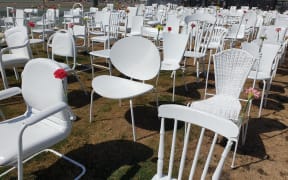
Various events across Christchurch are being held in commemoration of the 10th anniversary of the 22 February earthquake.
Doctor recalls amputation with pocket knife in Canterbury quake
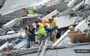
Ten years since the deadly Christchurch quake, which devastated the city on February 22, Dr Lydia Johns Putra tells Lisa Owen about her experience of saving the life of Brian Coker.
He was trapped in… Video, Audio
Christchurch city fringe suburbs see huge growth 10 years since earthquake
In the second of a two-part story, RNZ takes a look at the city's outskirts where families started their new lives after large areas of the city were red-zoned.
New Zealand
- Has cutting 'corporate welfare' left a hole in government climate plans?
- Kiwi student in New Caledonia taught to use fire extinguishers amid unrest
- Check before you tap: Consumer warning over PayWave surcharges
- Simon Bridges’ speeding offence considered before appointment as NZTA chairman: ‘I learned a valuable lesson’
- Fears Queenstown's homeless problem is about to snowball
- Backlash as UK supermarket trials sale of New Zealand lamb
Get the RNZ app
for ad-free news and current affairs

Top News stories
- What we know about Iran president Ebrahim Raisi's helicopter crash
New Zealand RSS
Follow RNZ News
Christchurch Case study
The Christchurch earthquake of February 2011
- The earthquake occurred on New Zealand’s South Island 10km to the West of Christchurch, Canterbury. It lasted only 10 seconds.
- The earthquake happened on a conservative plate margin between the Pacific Plate and the Australian Plate.
- The epicentre of the quake was just 2km west of the port town of Lyttelton
- It measured 6.3 on the Richter Magnitude scale.
- Christchurch is New Zealand’s second largest city and suffered extensive damage
- Killed 185 people
- The earthquake was only 5 km deep
- The earthquake struck at 12:51 pm on Tuesday, 22 February, 2011
- 6 months earlier on 4th September 2010 another massive magnitude 7.1 earthquake caused significant damage to Christchurch and the central Canterbury region, but with no direct fatalities.
Tectonic setting & Cause

The earthquake was created along a conservative plate margin where the Pacific Plate slid past the Australian Plate in the opposite direction. Where the plates move like this strain energy builds up as the plates lock in place, it reaches a critical level then is breaks, releasing seismic energy. The earthquake occurred on a fault running off this major plate boundary. It was a strike slip event along the fault, mostly horizontal movement with some vertical movement upwards. The earthquake generated its own significant aftershocks;
- 2 Hours after the main earthquake - Largest aftershock of magnitude 5.9
- The first week post event - 361+ aftershocks (magnitude 3+ foreshocks) in the first week
EFFECTS OF THE FEBRUARY 2011 EARTHQUAKE
Primary effects (caused directly by the earthquake)
- 185 people were killed in the earthquake. Over half of the deaths occurred in the six-storey Canterbury Television (CTV) Building, which collapsed and caught fire in the quake.
- 3,129 people injured
- April 2013, the total estimated cost had ballooned to $40 billion
- Significant liquefaction affected the eastern suburbs, producing around 400,000 tonnes of silt
- Building damage to the central city and eastern suburbs of Christchurch. The damage was made worse by buildings and infrastructure already being weakened by the 4 September 2010 earthquake and its aftershock. Up to 100,000 buildings were damaged and about 10,000 buildings needed to be demolished.
- 3.5 m tsunami waves in Tasman Lake, following quake-triggered glacier calving from Tasman Glacier
- Water pipes, roads, bridges, power lines, cell phone towers and ordinary phone lines were broken or damaged.
- 50% + of Central City buildings severely damaged including the city’s cathedral which lost its spire
Secondary effects (things that happen after the primary effects but often as a result of them)
- Some economists have estimated it will take the New Zealand economy 50 to 100 years to completely recover.
- 80% of the water and sewerage system was severely damaged
- An additional 1,293 people were injured in the aftermath
- Psychological impacts – in a survey post event (2013) 80% of respondents stated their lives had changed significantly since the earthquakes. Almost a third said the earthquakes had caused them financial problems, while 64% said they felt guilty that other Cantabrians were more affected by the earthquakes.
- Outmigration of a fifth of the city population
- The population, which had been growing for decades, declined in the years after the quake
- Damage to roads through liquefaction made it difficult for people and emergency services to move around
- Christchurch could no longer host Rugby World Cup matches so lost the benefits, e.g. tourism and income
- Schools had to join together
- Rescue crews from all over the world came to help. There were crews from Japan, the United States, the United Kingdom, Taiwan, Australia and other countries.
- Aid money poured in – Australia gave $5 million (Aus $) in aid.
- The government declared a state of national emergency, which stayed in force until 30 April 2011
- Domestic help was available - The Farmy Army was made up of 800 farmers who brought their farm machines and muscle to help clean up the city.
- The most vulnerable people were cared for and people were kept safe away from dangerous buildings
- Chemical toilets were provided for 30,000 residents
- The Red Cross and other charities supplied aid workers
- More than 300 Australian police officers flew into Christchurch three days after the earthquake.
- The government provided temporary housing and ensured all damaged housing was kept water tight
- Water and sewerage was restored for all residents by August
- Roads and houses were cleared of silt from liquefaction by August and 80% of roads & 50% of footpaths were repaired
- Many Non-government organisations including Save the Children helped with long term recovery efforts
- Canterbury Earthquake Recovery Authority was created to organise the REBUILD of the region. It had special powers to change planning laws and regulations.
Green Zone land was undamaged and could be built on again. Orange Zone more checks were needed before the land could be built on. White Zone was the area that had not been checked at all yet. Red Zone areas were very unstable: building on it safely would be difficult.
NEXT TOPIC - Why live in tectonic areas?
©2015 Cool Geography
- Copyright Policy
- Privacy & Cookies
- Testimonials
- Feedback & support

Case Study: Christchurch, New Zealand Earthquake
Earthquake case study - christchurch, new zealand.
Two earthquakes hit the city of Christchurch, on New Zealand's south-east coast, in late 2010/early 2011. The second one hit the city centre, killing 185 and destroying much of the CBD.
1st earthquake (4/9/10)
- Magnitude 7.1.
- People were asleep and the streets mostly empty.
- Buildings were weakened, which became an issue in the 2nd earthquake.
- E.g. 'Turtle safe' - an earthquake safety resource aimed at preschool children which encourages them to act like a turtle during an earthquake.
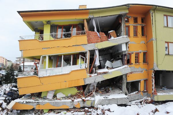
2nd earthquake (22/2/11) facts
- Magnitude 6.3, hit closer to the CBD than the first earthquake.
- Thousands of people were out and about at work and school.
- The city centre was busy.
- 130 deaths caused by the collapsing of the Canterbury TV and Pyne Gould Corporation buildings.
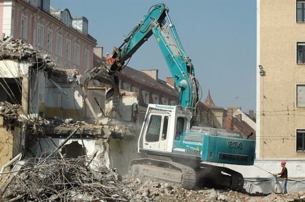
2nd earthquake damage
- The Provincial Council Chambers and the Anglican Christchurch Cathedral were completely destroyed.
- Over half of the buildings in the central business district have been (intentionally) demolished since as they were no longer safe, including the Hotel Grand Chancellor.
- Liquefaction sludge moved upwards through cracks in residential streets.
- Water and sewage from broken pipes flooded the streets.
- Several thousand homes in the 'red zone' were demolished because they could no longer be safely inhabited.


2nd earthquake responses
- State of emergency declared by national government on 23rd February.
- Christchurch's CBD was cordoned off until June 2013 in some locations.
- 75% of power reinstated within 96 hours.
- Local residents and the creative community have been taking over the 'empty spaces' in the CBD with art installations and street art.
1 Geography Skills
1.1 Mapping
1.1.1 Map Making
1.1.2 OS Maps
1.1.3 Grid References
1.1.4 Contour Lines
1.1.5 Symbols, Scale and Distance
1.1.6 Directions on Maps
1.1.7 Describing Routes
1.1.8 Map Projections
1.1.9 Aerial & Satellite Images
1.1.10 Using Maps to Make Decisions
1.2 Geographical Information Systems
1.2.1 Geographical Information Systems
1.2.2 How do Geographical Information Systems Work?
1.2.3 Using Geographical Information Systems
1.2.4 End of Topic Test - Geography Skills
2 Geology of the UK
2.1 The UK's Rocks
2.1.1 The UK's Main Rock Types
2.1.2 The UK's Landscape
2.1.3 Using Rocks
2.1.4 Weathering
2.2 Case Study: The Peak District
2.2.1 The Peak District
2.2.2 Limestone Landforms
2.2.3 Quarrying
3 Geography of the World
3.1 Geography of America & Europe
3.1.1 North America
3.1.2 South America
3.1.3 Europe
3.1.4 The European Union
3.1.5 The Continents
3.1.6 The Oceans
3.1.7 Longitude
3.1.8 Latitude
3.1.9 End of Topic Test - Geography of the World
4 Development
4.1 Development
4.1.1 Classifying Development
4.1.3 Evaluation of GDP
4.1.4 The Human Development Index
4.1.5 Population Structure
4.1.6 Developing Countries
4.1.7 Emerging Countries
4.1.8 Developed Countries
4.1.9 Comparing Development
4.2 Uneven Development
4.2.1 Consequences of Uneven Development
4.2.2 Physical Factors Affecting Development
4.2.3 Historic Factors Affecting Development
4.2.4 Human & Social Factors Affecting Development
4.2.5 Breaking Out of the Poverty Cycle
4.3 Case Study: Democratic Republic of Congo
4.3.1 The DRC: An Overview
4.3.2 Political & Social Factors Affecting Development
4.3.3 Environmental Factors Affecting the DRC
4.3.4 The DRC: Aid
4.3.5 The Pros & Cons of Aid in DRC
4.3.6 Top-Down vs Bottom-Up in DRC
4.3.7 The DRC: Comparison with the UK
4.3.8 The DRC: Against Malaria Foundation
4.4 Case Study: Nigeria
4.4.1 The Importance & Development of Nigeria
4.4.2 Nigeria's Relationships with the Rest of the World
4.4.3 Urban Growth in Lagos
4.4.4 Population Growth in Lagos
4.4.5 Factors influencing Nigeria's Growth
4.4.6 Nigeria: Comparison with the UK
5 Weather & Climate
5.1 Weather
5.1.1 Weather & Climate
5.1.2 Components of Weather
5.1.3 Temperature
5.1.4 Sunshine, Humidity & Air Pressure
5.1.5 Cloud Cover
5.1.6 Precipitation
5.1.7 Convectional Precipitation
5.1.8 Frontal Precipitation
5.1.9 Relief or Orographic Precipitation
5.1.10 Wind
5.1.11 Extreme Wind
5.1.12 Recording the Weather
5.1.13 Extreme Weather
5.2 Climate
5.2.1 Climate of the British Isles
5.2.2 Comparing Weather & Climate London
5.2.3 Climate of the Tropical Rainforest
5.2.4 End of Topic Test - Weather & Climate
5.3 Tropical Storms
5.3.1 Formation of Tropical Storms
5.3.2 Features of Tropical Storms
5.3.3 The Structure of Tropical Storms
5.3.4 Tropical Storms Case Study: Katrina Effects
5.3.5 Tropical Storms Case Study: Katrina Responses
6 The World of Work
6.1 Tourism
6.1.1 Landscapes
6.1.2 The Growth of Tourism
6.1.3 Benefits of Tourism
6.1.4 Economic Costs of Tourism
6.1.5 Social, Cultural & Environmental Costs of Tourism
6.1.6 Tourism Case Study: Blackpool
6.1.7 Ecotourism
6.1.8 Tourism Case Study: Kenya
7 Natural Resources
7.1.1 What are Rocks?
7.1.2 Types of Rock
7.1.4 The Rock Cycle - Weathering
7.1.5 The Rock Cycle - Erosion
7.1.6 What is Soil?
7.1.7 Soil Profiles
7.1.8 Water
7.1.9 Global Water Demand
7.2 Fossil Fuels
7.2.1 Introduction to Fossil Fuels
7.2.2 Fossil Fuels
7.2.3 The Global Energy Supply
7.2.5 What is Peak Oil?
7.2.6 End of Topic Test - Natural Resources
8.1 River Processes & Landforms
8.1.1 Overview of Rivers
8.1.2 The Bradshaw Model
8.1.3 Erosion
8.1.4 Sediment Transport
8.1.5 River Deposition
8.1.6 River Profiles: Long Profiles
8.1.7 River Profiles: Cross Profiles
8.1.8 Waterfalls & Gorges
8.1.9 Interlocking Spurs
8.1.10 Meanders
8.1.11 Floodplains
8.1.12 Levees
8.1.13 Case Study: River Tees
8.2 Rivers & Flooding
8.2.1 Flood Risk Factors
8.2.2 Flood Management: Hard Engineering
8.2.3 Flood Management: Soft Engineering
8.2.4 Flooding Case Study: Boscastle
8.2.5 Flooding Case Study: Consequences of Boscastle
8.2.6 Flooding Case Study: Responses to Boscastle
8.2.7 Flooding Case Study: Bangladesh
8.2.8 End of Topic Test - Rivers
8.2.9 Rivers Case Study: The Nile
8.2.10 Rivers Case Study: The Mississippi
9.1 Formation of Coastal Landforms
9.1.1 Weathering
9.1.2 Erosion
9.1.3 Headlands & Bays
9.1.4 Caves, Arches & Stacks
9.1.5 Wave-Cut Platforms & Cliffs
9.1.6 Waves
9.1.7 Longshore Drift
9.1.8 Coastal Deposition
9.1.9 Spits, Bars & Sand Dunes
9.2 Coast Management
9.2.1 Management Strategies for Coastal Erosion
9.2.2 Case Study: The Holderness Coast
9.2.3 Case Study: Lyme Regis
9.2.4 End of Topic Test - Coasts
10 Glaciers
10.1 Overview of Glaciers & How They Work
10.1.1 Distribution of Glaciers
10.1.2 Types of Glaciers
10.1.3 The Last Ice Age
10.1.4 Formation & Movement of Glaciers
10.1.5 Shaping of Landscapes by Glaciers
10.1.6 Glacial Landforms Created by Erosion
10.1.7 Glacial Till & Outwash Plain
10.1.8 Moraines
10.1.9 Drumlins & Erratics
10.1.10 End of Topic Tests - Glaciers
10.1.11 Tourism in Glacial Landscapes
10.1.12 Strategies for Coping with Tourists
10.1.13 Case Study - Lake District: Tourism
10.1.14 Case Study - Lake District: Management
11 Tectonics
11.1 Continental Drift & Plate Tectonics
11.1.1 The Theory of Plate Tectonics
11.1.2 The Structure of the Earth
11.1.3 Tectonic Plates
11.1.4 Plate Margins
11.2 Volcanoes
11.2.1 Volcanoes & Their Products
11.2.2 The Development of Volcanoes
11.2.3 Living Near Volcanoes
11.3 Earthquakes
11.3.1 Overview of Earthquakes
11.3.2 Consequences of Earthquakes
11.3.3 Case Study: Christchurch, New Zealand Earthquake
11.4 Tsunamis
11.4.1 Formation of Tsunamis
11.4.2 Case Study: Japan 2010 Tsunami
11.5 Managing the Risk of Volcanoes & Earthquakes
11.5.1 Coping With Earthquakes & Volcanoes
11.5.2 End of Topic Test - Tectonics
12 Climate Change
12.1 The Causes & Consequences of Climate Change
12.1.1 Evidence for Climate Change
12.1.2 Natural Causes of Climate Change
12.1.3 Human Causes of Climate Change
12.1.4 The Greenhouse Effect
12.1.5 Effects of Climate Change on the Environment
12.1.6 Effects of Climate Change on People
12.1.7 Climate Change Predictions
12.1.8 Uncertainty About Future Climate Change
12.1.9 Mitigating Against Climate Change
12.1.10 Adapting to Climate Change
12.1.11 Case Study: Bangladesh
13 Global Population & Inequality
13.1 Global Populations
13.1.1 World Population
13.1.2 Population Structure
13.1.3 Ageing Populations
13.1.4 Youthful Populations
13.1.5 Population Control
13.1.6 Mexico to USA Migration
13.1.7 End of Topic Test - Development & Population
14 Urbanisation
14.1 Urbanisation
14.1.1 Rural Characterisitcs
14.1.2 Urban Characteristics
14.1.3 Urbanisation Growth
14.1.4 The Land Use Model
14.1.5 Rural-Urban Pull Factors
14.1.6 Rural-Urban Push Factors
14.1.7 The Impacts of Migration
14.1.8 Challenges of Urban Areas in Developed Countries
14.1.9 Challenges of Urban Areas in Developing Countries
14.1.10 Urban Sustainability
14.1.11 Case Study: China's Urbanisation
14.1.12 Major UK Cities
14.1.13 Urbanisation in the UK
14.1.14 End of Topic Test- Urbanisation
14.1.15 End of Topic Test - Urban Issues
15 Ecosystems
15.1 The Major Biomes
15.1.1 Distribution of Major Biomes
15.1.2 What Affects the Distribution of Biomes?
15.1.3 Biome Features: Tropical Forests
15.1.4 Biome Features: Temperate Forests
15.1.5 Biome Features: Tundra
15.1.6 Biome Features: Deserts
15.1.7 Biome Features: Tropical Grasslands
15.1.8 Biome Features: Temperate Grasslands
15.2 Case Study: The Amazon Rainforest
15.2.1 Interdependence of Rainforest Ecosystems
15.2.2 Nutrient Cycling in Tropical Rainforests
15.2.3 Deforestation in the Amazon
15.2.4 Impacts of Deforestation in the Amazon
15.2.5 Protecting the Amazon
15.2.6 Adaptations of Plants to Rainforests
15.2.7 Adaptations of Animals to Rainforests
16 Life in an Emerging Country
16.1 Case Studies
16.1.1 Mumbai: Opportunities
16.1.2 Mumbai: Challenges
17 Analysis of Africa
17.1 Africa
17.1.1 Desert Biomes in Africa
17.1.2 The Semi-Desert Biome
17.1.3 The Savanna Biome
17.1.4 Overview of Tropical Rainforests
17.1.5 Colonisation History
17.1.6 Population Distribution in Africa
17.1.7 Economic Resources in Africa
17.1.8 Urbanisation in Africa
17.1.9 Africa's Location
17.1.10 Physical Geography of Africa
17.1.11 Desertification in Africa
17.1.12 Reducing the Risk of Desertification
17.1.13 Case Study: The Sahara Desert - Opportunities
17.1.14 Case Study: The Sahara Desert - Development
18 Analysis of India
18.1 India - Physical Geography
18.1.1 Geographical Location of India
18.1.2 Physical Geography of India
18.1.3 India's Climate
18.1.4 Natural Disasters in India
18.1.5 Case Study: The Thar Desert
18.1.6 Case Study: The Thar Desert - Challenges
18.2 India - Human Geography
18.2.1 Population Distribution in India
18.2.2 Urabinsation in India
18.2.3 The History of India
18.2.4 Economic Resources in India
19 Analysis of the Middle East
19.1 The Middle East
19.1.1 Physical Geography of the Middle East
19.1.2 Human Geography of the Middle East
19.1.3 Climate Zones in the Middle East
19.1.4 Climate Comparison with the UK
19.1.5 Oil & Natural Gas in the Middle East
19.1.6 Water in the Middle East
19.1.7 Population of the Middle East
19.1.8 Development Case Studies: The UAE
19.1.9 Development Case Studies: Yemen
19.1.10 Supporting Development in Yemen
19.1.11 Connection to the UK
19.1.12 Importance of Oil
19.1.13 Oil & Tourism in the UAE
20 Analysis of Bangladesh
20.1 Bangladesh Physical Geography
20.1.1 Location of Bangladesh
20.1.2 Climate of Bangladesh
20.1.3 Rivers in Bangladesh
20.1.4 Flooding in Bangladesh
20.2 Bangladesh Human Geography
20.2.1 Population Structure in Bangladesh
20.2.2 Urbanisation in Bangladesh
20.2.3 Bangladesh's Economy
20.2.4 Energy & Sustainability in Bangladesh
21 Analysis of Russia
21.1 Russia's Physical Geography
21.1.1 Russia's Climate
21.1.2 Russia's Landscape
21.2 Russia's Human Geography
21.2.1 Population of Russia
21.2.2 Russia's Economy
21.2.3 Energy & Sustainability in Russia
Jump to other topics

Unlock your full potential with GoStudent tutoring
Affordable 1:1 tutoring from the comfort of your home
Tutors are matched to your specific learning needs
30+ school subjects covered
Consequences of Earthquakes
Formation of Tsunamis
- 0 Shopping Cart

New Zealand Earthquake 2016
A powerful magnitude-7.8 earthquake struck New Zealand’s South Island, killing at least two people, on November 14th 2016. The earthquake occurred at 00.02 am.
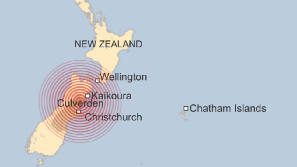
2016 New Zealand Earthquake Map – Source BBC News
It was felt as far afield as the capital Wellington on the North Island, 120 miles (200km) away.
A tsunami arrived about two hours later. People along the eastern coast were warned to head inland or to higher ground.
Primary Effects of the 2016 New Zealand Earthquake
- Two people died.
- Fifty people were injured.
- Sixty people needed emergency housing.
- Over 190km of roads and 200km of railway lines were destroyed
- Twenty thousand buildings were damaged or destroyed.
- Water, sewerage & power supplies were cut off.
- Total damage is estimated at US $8.5 billion.
Secondary Effects of the 2016 New Zealand Earthquake
- One hundred thousand landslides blocked roads and railways.
- A landslide blocked the Clarence River, causing flooding. Ten farms were evacuated.
- The earthquake triggered a tsunami of 5m, leaving debris up to250 metres inland.
Immediate Responses to the 2016 New Zealand Earthquake
- A tsunami warning was issued, and residents were told to get to higher ground.
- Hundreds were housed in emergency shelters.
- Two hundred vulnerable people were evacuated by helicopter.
- Power was restored within hours. International warships were sent to Kaikoura with supplies such as food, medicine and portable toilets.
- Temporary water supplies set up.
- Other countries sent food and medicine.
Long-term Responses to the 2016 New Zealand Earthquake
- $5.3 million from District Council for repairs and rebuilding.
- Road and rail routes reopened within two years.
- A relief fund was set up to provide basic supplies.
- By March 2017, a permanent water main had been laid in Kaikoura. the new pipe was designed to move with any future earthquakes so it won’t break

Premium Resources
Please support internet geography.
If you've found the resources on this page useful please consider making a secure donation via PayPal to support the development of the site. The site is self-funded and your support is really appreciated.
Related Topics
Use the images below to explore related GeoTopics.
Topic Home
Next topic page, share this:.
- Click to share on Twitter (Opens in new window)
- Click to share on Facebook (Opens in new window)
- Click to share on Pinterest (Opens in new window)
- Click to email a link to a friend (Opens in new window)
- Click to share on WhatsApp (Opens in new window)
- Click to print (Opens in new window)
If you've found the resources on this site useful please consider making a secure donation via PayPal to support the development of the site. The site is self-funded and your support is really appreciated.
Search Internet Geography
Top posts and pages.
Latest Blog Entries
Pin It on Pinterest
- Click to share
- Print Friendly

IMAGES
VIDEO
COMMENTS
The earthquake occurred on New Zealand's South Island, 10km west of Christchurch, at 12.51 pm on 22nd February 2011 and lasted just 10 seconds. Measuring 6.3 on the Richter Scale and, at 4.99 km deep, the earthquake was very shallow. The earthquake occurred along a conservative margin between the Pacific Plate and the Australasian Plate.
Christchurch, New Zealand, earthquakes of 2010-11. The principal event, sometimes referred to as the Darfield earthquake, struck at 4:35 am on September 4, 2010. The earthquake's epicentre was located some 25 miles (40 km) west of Christchurch near the town of Darfield, and the focus was located about 6 miles (10 km) beneath the surface.
Impacts of earthquakes; Case study: Christchurch 2011 (HIC) Case study: Nepal 2015 (LMIC) ... The earthquake struck the city of Christchurch in New Zealand on 22 February 2011. It was a 6.3 ...
Summary. On February 22, 2011, residents of the then-second-largest city in New Zealand - Christchurch, located on the South Island's Canterbury Plains - were hit hard by a magnitude 6.3 earthquake. Outside of New Zealand, the earthquake became known as the "Christchurch Earthquake", and it resulted in the deaths of 185 people and injuries ...
A major earthquake occurred in Christchurch on Tuesday 22 February 2011 at 12:51 p.m. local time (23:51 UTC, 21 February). The M w 6.2 (M L 6.3) earthquake struck the Canterbury region in the South Island, centred 6.7 kilometres (4.2 mi) south-east of the central business district. It caused widespread damage across Christchurch, killing 185 people in New Zealand's fifth-deadliest disaster.
Then and now: How the 2011 Christchurch earthquakes changed the city. 7:31 pm on 20 February 2021. Share this. As residents mark the anniversary of the 22 February earthquakes, RNZ takes a look at what has become of the city in the past 10 years. The 6.3 magnitude quake hit in the afternoon followed by strong aftershocks, killing 185 people ...
The 2010 and 2011 earthquakes in Christchurch, New Zealand, resulted in significant loss of life and injury and in the devastation of much of the center and east of the city. ... a case study of ...
The earthquake struck New Zealand's South Island, 10km west of Christchurch, at 12:51 pm on 22nd February 2011, lasting just 10 seconds. It measured 6.3 on the Richter Scale and had a shallow depth of 4.99 km.
Christchurch earthquake in 2011 as our case study. The Christchurch earthquake sequence of 2010-2011 was the worst natural disaster in New Zealand's history, with an estimated loss of USD 35 billion.2 The first major quake in this sequence was in September 2010 with a magnitude of 7.1. The second and third major
Case Study Report: 2010 Canterbury and 2011 Christchurch Earthquakes - Demolition and Disaster Waste Management April 2012 Charlotte Brown Mark Milke Executive Summary On 4 September 2010, the Canterbury region of New Zealand was struck by a 7.1 magnitude earthquake. The event caused significant damage but no loss of lives.
At 1251 h on Feb 22, 2011, an earthquake struck Christchurch, New Zealand, causing widespread destruction. The only regional acute hospital was compromised but was able to continue to provide care, supported by other hospitals and primary care facilities in the city. 6659 people were injured and 182 died in the initial 24 h. The massive peak ground accelerations, the time of the day, and the ...
Christchurch is New Zealand's second largest city and suffered extensive damage. Killed 185 people. The earthquake was only 5 km deep. The earthquake struck at 12:51 pm on Tuesday, 22 February, 2011. 6 months earlier on 4th September 2010 another massive magnitude 7.1 earthquake caused significant damage to Christchurch and the central ...
The 2010/2011 Canterbury Earthquake Sequence caused severe loss and disruption in Christchurch, New Zealand. The most damaging event (M6.2, 5-km deep, 10-km SE of the Christchurch Central Business District (CBD)) occurred 22 February 2011 and resulted in 185 fatalities and widespread impacts on the community including loss of land and infrastructure due to liquefaction and damage from strong ...
At 12.51 p.m. on 22 February 2011, the Canterbury region was struck by a magnitude 6.3 earthquake. At the time it was still recovering from the effects of a 7.1-magnitude earthquake on 4 September 2010.Though smaller than the first quake, and technically part of its aftershock sequence, the February earthquake was more destructive.
OPEN DATA'S IMPACT | Open Data's Use After Christchurch Earthquakes 4 I. CONTEXT AND BACKGROUND New Zealand is a high-income Pacifi c Island nation with a population of 4.6 million.1 It was ranked seventh on the UN Human Development Index in 2013.2 The country is located on the Pacifi c Ring of Fire, where the Australian and Pacifi c plates meet, and is seismically active.
The earthquakes that struck Christchurch, New Zealand, in 2010-11 ruptured both the material and sociocultural architectures of the city. Subsequent examinations of the landscape have explored the alternative imaginations and narrations of urban space that have taken hold during recovery.
This earthquake exceeded New Zealand's strong ground motion data since the beginning of the recording, which established in the 1960's. The peak recorded horizontal acceleration was 0.82 g, and peak velocity was found to be above 1 m/s. Surprisingly, one site located near to the fault recorded the vertical acceleration of 1.26 g.
75% of power reinstated within 96 hours. Local residents and the creative community have been taking over the 'empty spaces' in the CBD with art installations and street art. Two earthquakes hit the city of Christchurch, on New Zealand's south-east coast, in late 2010/early 2011. The second one hit the city centre, killing 185 and destroying ...
Before 2011, Christchurch was not a place one readily associated with a high earthquake risk. Unlike the capital Wellington, Christchurch does not sit near New Zealand's main fault lines. It is located on New Zealand's South Island, has a population of 380 000 (total country population is 4.2 million) and consists of 99 500 houses, 30 000 flats
Kam W. Y., Pampanin S., and Elwood K., 2011. Seismic performance of reinforced concrete buildings in the 22 February Christchurch (Lyttelton) earthquake, Bulletin of the New Zealand Society of Earthquake Engineering 44 (Special Issue), 239-279.
Case Study of the 2010-2011 Canterbury, New Zealand Earthquake Sequence Authors Scott Miles, Western Washington University ... New Zealand Earthquake Sequence I. INTRODUCTION The World Reconstruction Conference (WRC) in Geneva in May 2011 recommended the ... Christchurch exceeded 1.8g (i.e., 1.8 times the acceleration of gravity), with 2.2g in ...
A powerful magnitude-7.8 earthquake struck New Zealand's South Island, killing at least two people, on November 14th 2016. The earthquake occurred at 00.02 am. 2016 New Zealand Earthquake Map - Source BBC News. It was felt as far afield as the capital Wellington on the North Island, 120 miles (200km) away. A tsunami arrived about two hours ...
Earthquakes can influence flood hazards by altering the flux, volumes, and distributions of surface and/or subsurface waters and causing physical changes to natural and engineered environments (e.g., elevation, topographic relief, permeability) that affect surface and subsurface hydrologic regimes. This paper analyzes how earthquakes increased flood hazards in Christchurch, New Zealand, using ...